Telangana State is the 29th State of India bordering Maharashtra state on North West, Karnataka on West and Andhra Pradesh State on East and South. The region has an area of 276.96 lakh acres and a population of 350.04 lakhs as per the 2011 census.
Agriculture and its allied activities provide livelihoods to more than half of the state’s workforce (around 60% of the workforce in the state is engaged in agriculture and allied activities). [Reference: Agriculture Action Plan 2021- 22]
Telangana has identified agriculture as a priority sector and the State is focusing on developing AI-based solutions for a digital revolution to benefit the farmers and policymakers.
SatSure is working with the Telangana Government to enable remote digitisation of the farm lands and create a digital crop registry through its SatSure Sparta Maps, which is the first step towards digitisation and enabling efficient resources allocation to the farmers.
What is SatSure Sparta Maps?
While data holds the potential to provide key insights for making agriculture value chain decisions, field data collection can be complex, especially for large areas as it is challenging to maintain accuracy and consistency due to the lack of standardization. Additionally, the manual data collection process with physical paper documentation can be expensive, time-consuming, and prone to human errors.
SatSure Sparta Maps with features like field data collection and farm digitisation, enables easy collection of agriculture and allied field data by crowdsourcing and makes it available to the concerned stakeholders.
Reinforcing our idea of open innovation, both individual and enterprise-level users can access SatSure’s spatial data layers in mobile devices and enhance the on-field work and experience.
The application is very easy-to-use with a simple user interface (UI) and comes with user guides available for direct consumption and usage.
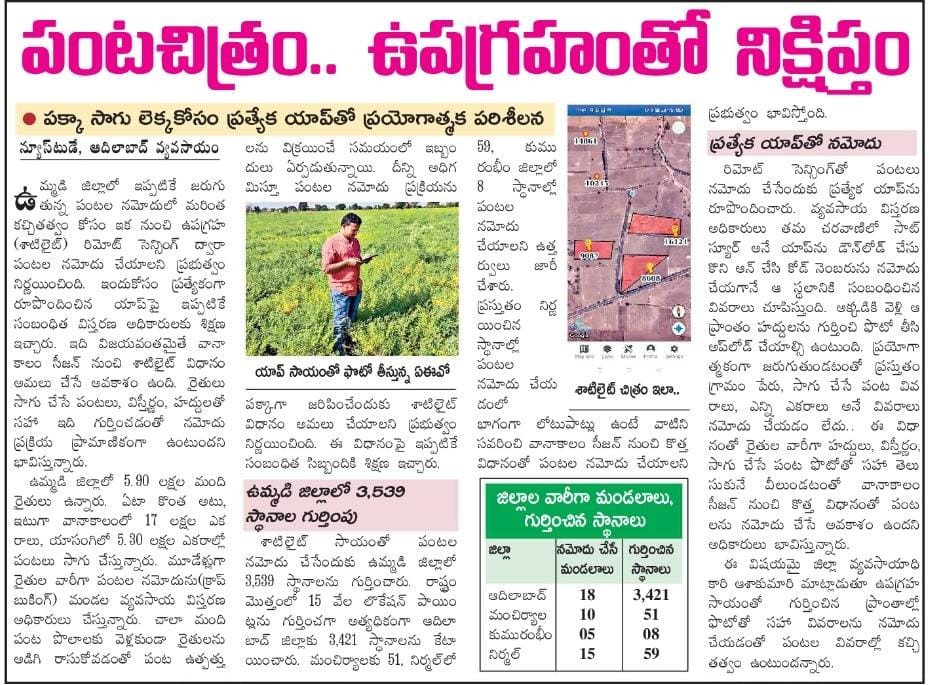
Case Study: How is the Telangana Government using SatSure Sparta Maps?
SatSure has demonstrated the potential benefits of using SatSure Sparta Maps for seamless collection and digitisation of field data through our work with the State Government of Telangana.
The Agricultural Ministry of the Telangana Government required extensive ground truth data from agricultural fields for crop registration followed by continuous monitoring of the crop throughout the cropping season at different granularities like farm, village, taluka and clusters, to capture the crops and their varieties.
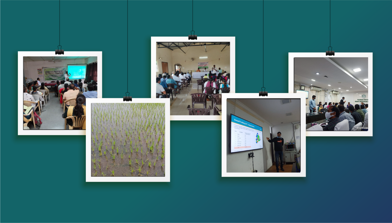
With this intent, SatSure and the Telangana government have undertaken a beta project using SatSure Sparta Maps. We conducted an extensive training session for the agricultural extension officers and Government officials on the usage of mobile application.
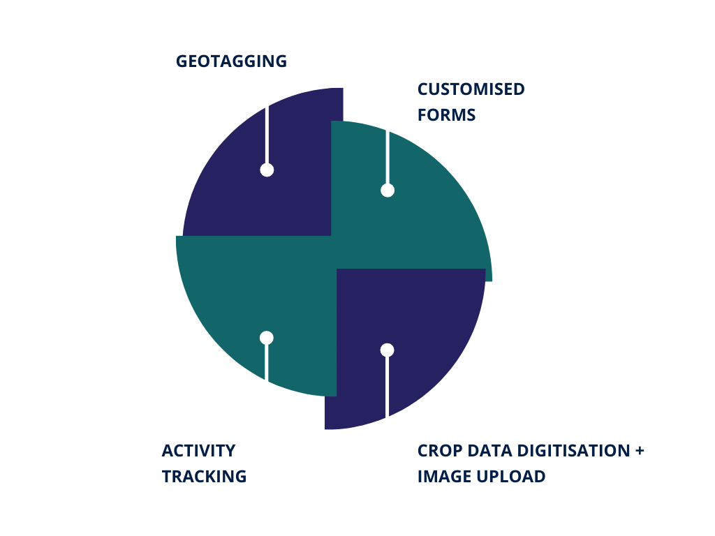
The agricultural extension officers are using the application for the following:
The relevant extension officers have been trained to use the application allowing them access to the farm details, crop grown, and farm area, taking the first step towards farm and crop digitisation for the field staff. Thus, for the State Government, the process of crop registration which forms an important part of enabling access to resources like fertilizers, seeds and subsidies for the farmers is being done in the first phase of the project which will also allow the Telangana Government to monitor different types of crops across its districts.
Conclusion
SatSure aims to solve the real problems faced by the agricultural industry by using insights derived through geospatial analytics. Our team is constantly upgrading its products and platforms to help the ecosystem get actionable insights to improve agricultural data consumption and exchange experience.
For developing countries, the first step towards consumption is the digitisation of land parcels and processes, which is what we aim to do with SatSure Sparta Maps, and as our contribution to the growing ecosystem have kept the feature of geotagging and field data capture open for use along with access to open field records.
Reach out to us at sparta@satsure.co to know more about our open innovation initiatives.
This story was originally published on our LinkedIn.